How death of Aral Sea was split in two by thirteen kilometres of concrete

The Kokaral Dam in Kazakhstan, which is 13 kilometres long, is barely visible from the orbit. Behind that thin line, the North Aral Sea has grown by more than a third, fish have returned and the water is drawing closer to the old port of Aralsk.
We speak of healing as though it were whole. As though a body, wounded, restores itself entirely or not at all. But the oldest knowledge of the living world tells a different story. A tree struck by lightning does not regrow the lost limb. It grows around the wound. The new wood is denser than the original grain, tighter in its rings, and harder in its purpose.
Botanists call it wound-wood, and it is not a return to what was. It is something new: tissue that remembers the injury by growing stronger in its place, while the scar itself remains, open to the weather, slowly becoming part of the trunk’s geography. The tree does not choose which side to save. The sap chooses its path, flowing through the channel that remains.
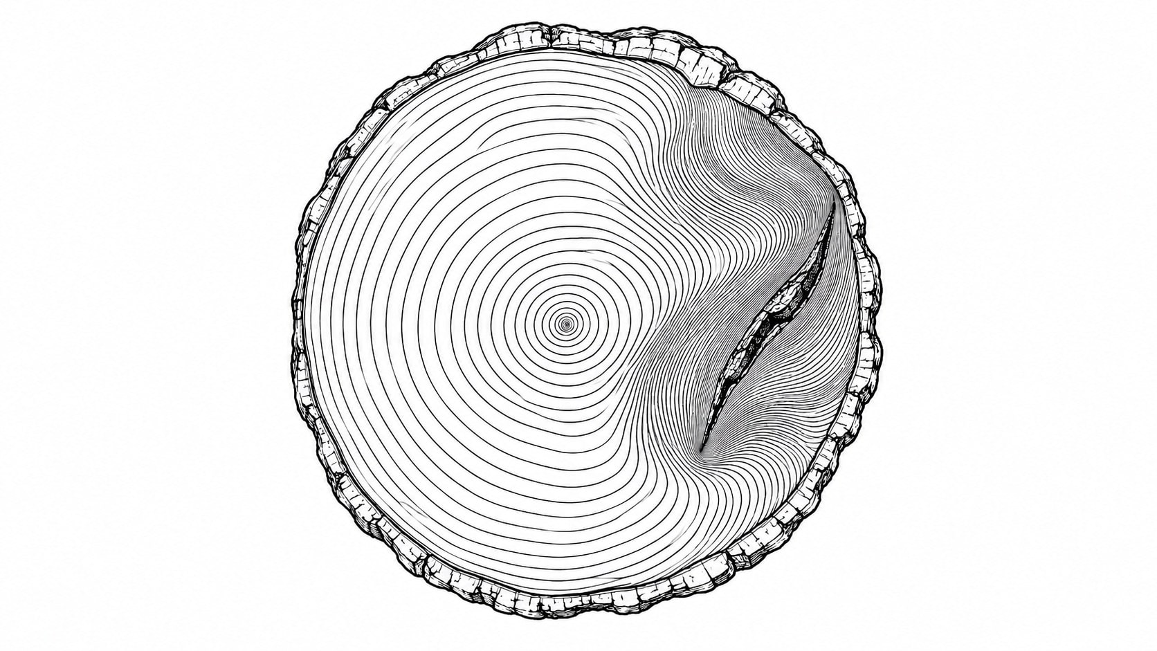
Wound-wood: the denser grain that grows where the trunk was broken. Image: ATGEO
In 1884, a Russian climatologist named Aleksandr Voeikov published a work of sweeping ambition. He understood, with a clarity rare for his century, that water was not merely a substance but a system: that rivers, rainfall, evaporation, and vegetation formed a single circulatory pattern across landscapes, and that to interrupt one was to alter all the others.
Read more: Kazakhstan to make its part of Aral Sea full again
Somewhere in his writings on Central Asian hydrology, Voeikov referred to the Aral Sea as a «useless evaporator”. The fourth-largest inland body of water on Earth: 68,000 square kilometres of salt lake straddling what are now Kazakhstan and Uzbekistan, a body of water that had moderated the region’s climate for millennia and sustained a fishing industry employing 40,000 workers, yielding one-sixth of the Soviet Union’s entire fish catch.
Useless. An evaporator. A mistake of nature.
Rivers diverted for cotton
For decades after Voeikov’s death in 1916, Soviet water officials cited his phrase as intellectual permission. In 1968, a Soviet engineer told the press, “It is obvious to everyone that the evaporation of the Aral Sea is inevitable.»
The canals had already been cut. The Amu Darya and the Syr Darya, the two rivers that fed the sea, were being bled into cotton fields across Uzbekistan and Turkmenistan. By 1960, between twenty and sixty cubic kilometres of water a year were going to the land instead of to the sea. Cotton was the plan. White gold. The desert would bloom. The sea would go.
It went.
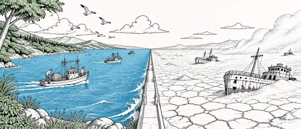
The Aral splits in two
By 1987 the water level had dropped so far that the Aral split into two separate bodies: a small northern sea in Kazakhstan, fed by the Syr Darya, and a vast southern sea in Uzbekistan, fed by the Amu Darya, or rather no longer fed by it.
By the time the Soviet Union collapsed, the fishing industry had collapsed first. Forty-five thousand people left the northern Aral region between 1980 and 2000. The port town of Aralsk, which had once stood on the shore, now found itself a hundred kilometres from the nearest water.
The side story: Uzbekistan and Kazakhstan plant saxaul to stabilise Aral Sea’s bed
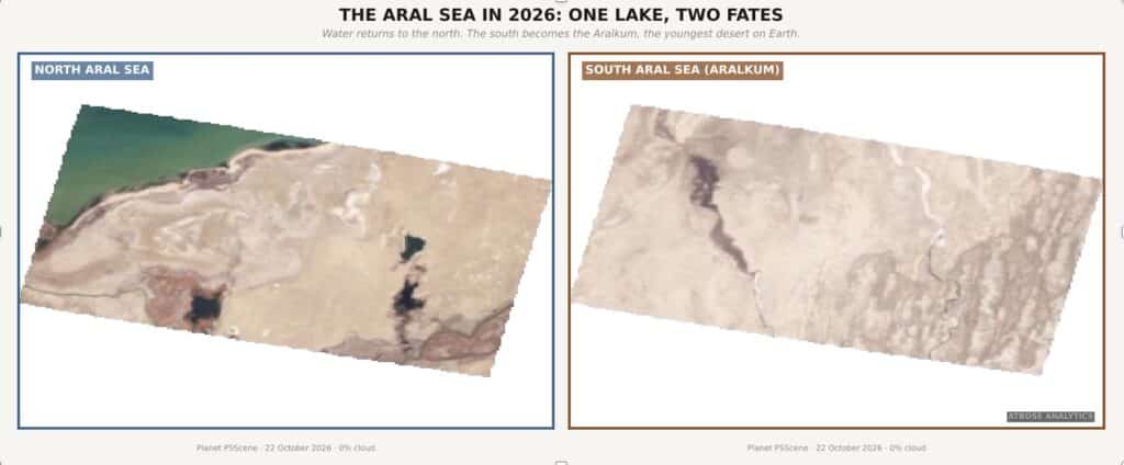
Figure 1. The Aral Sea in 2026: one lake, two fates. Planet PSScene, 22 October 2026. ATBOSE ANALYTICS.
Where the atlas once held a single blue expanse, the satellite now records two entirely different surfaces. The eastern basin of the South Aral Sea dried up completely in 2014. It is now the Aralkum: the youngest desert on Earth, a white crust of salt and toxic dust that appears in satellite imagery as a blank where blue once was. The western lobe continues to recede, its coastline drawing inward in every annual composite like a breath that will not be released.
In the north, the image is reversed. The Small Aral Sea is blue and is growing bluer. Its surface area has expanded by thirty-six per cent in twenty years. Its volume has nearly doubled, reaching twenty-four billion cubic metres by early 2026. Its salinity has halved. Twenty-two fish species that had vanished have returned, and the annual catch has reached eight thousand tonnes, a figure that would have been unimaginable a decade ago. The water, which had retreated a hundred kilometres from Aralsk, is now twelve kilometres away.
How Kokaral saved the North Aral
Between the blue and the white, running thirteen kilometres across what was once the floor of a single sea, sits a concrete dam.
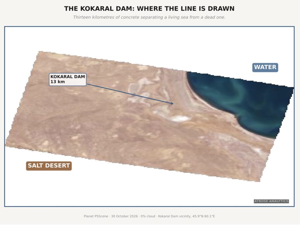
Figure 2. The Kokaral Dam: where the line is drawn. Planet PSScene, 30 October 2026. ATBOSE ANALYTICS.
The Kokaral Dam was completed in August 2005 with eighty-six million dollars from the World Bank and the government of Kazakhstan. It is not a feat of architectural grandeur. It is a wall across a strait that no longer connects two waters. It was built to do one thing: to hold the Syr Darya’s flow inside the Small Aral and stop it draining south into the larger basin, where it would evaporate before it could accumulate. To save the small part, the large part must be let go.
From orbit, the Kokaral Dam is almost invisible. What is visible is its consequence. One side: water, vegetation returning to the delta, the thermal signature of a living ecosystem. The other side: salt, dust, and the spectral blankness of a surface that returns to the sun everything the sun sends down.
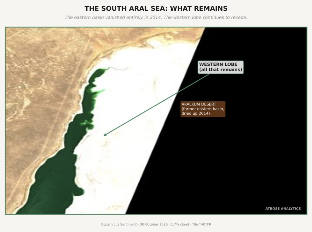
Figure 3. The South Aral Sea: what remains. Copernicus Sentinel-2, 30 October 2026. ATBOSE ANALYTICS.
Only the archive knows the difference. Only the time series, frame by frame from Landsat 1972 to Sentinel-2 2026, reveals that this white expanse was once the floor of a sea where port towns worked through the night and trawlers filled their holds, and the presence of so much water softened the summer heat and shortened the winter cold across the entire basin.
Kazakhstan plans to raise the dam
Between 2026 and 2029, Kazakhstan plans to raise the Kokaral Dam higher and wider, lifting the water level from 40.4 to 44 metres above the Baltic datum and expanding the volume to thirty-four billion cubic metres. Four and a half million seedlings have already been planted on the dried seabed of the southern basin, young saxaul trees threading their roots through salt crust, the desert’s own attempt at wound wood across a surface that was water within living memory.
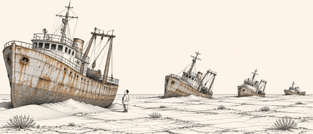
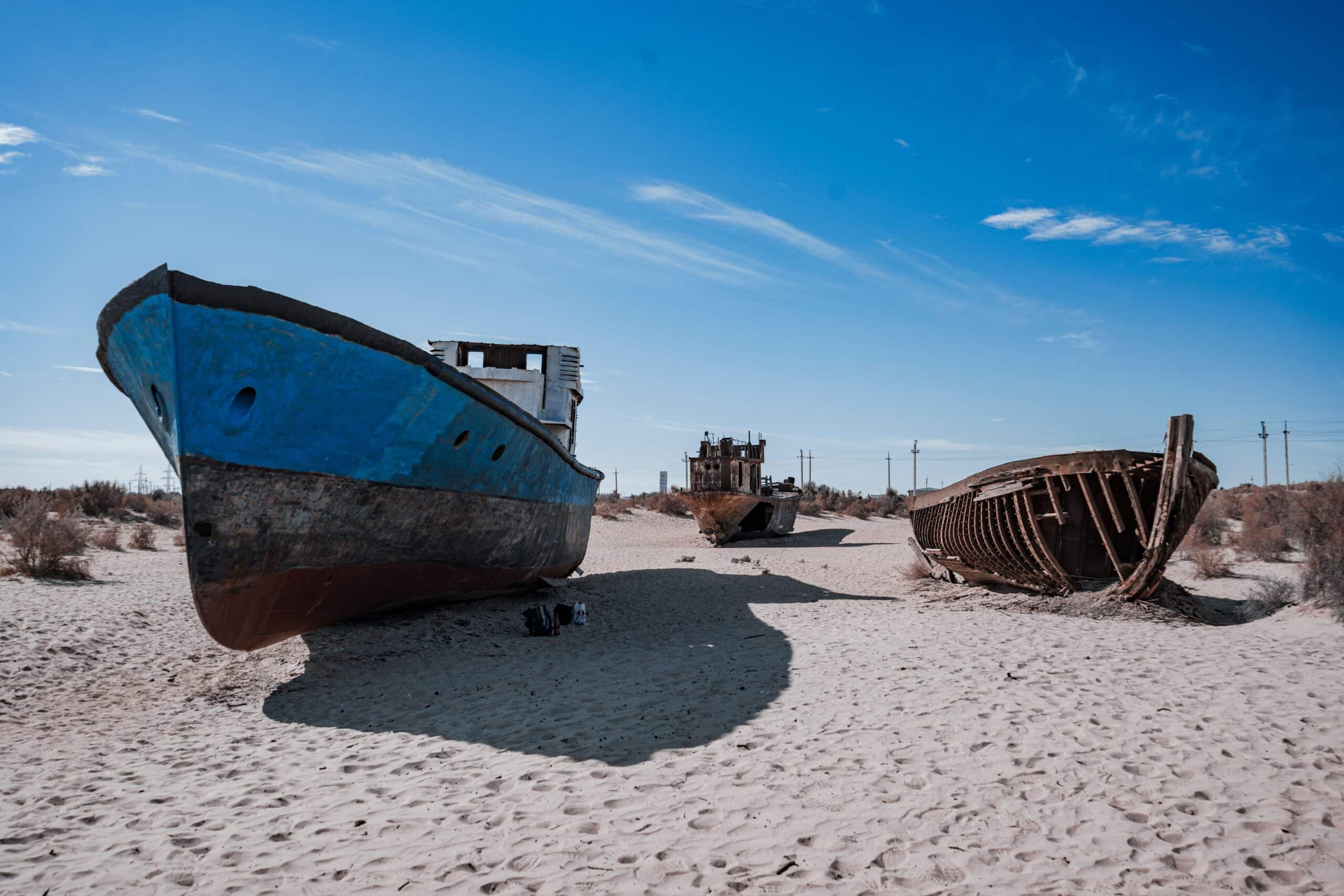
Fishing boats a hundred kilometres from the nearest water in Muynak. Image: ATGEO
The North Aral Sea in 2026 is not the Aral Sea of 1960. It is smaller, saltier, shallower, and contained by a wall that did not exist in nature. It is wound-wood.
And on the dam’s southern side, visible from orbit in every cloudless pass, the Aralkum stretches white and still toward Muynak, where rusting fishing boats stand in sand a hundred kilometres from the nearest shore, a graveyard of vessels so far from any water that a visitor who did not know the history might believe they had been placed there as a sculpture, as a monument, as a question the desert is asking and no one is required to answer.
The question is not whether a sea can be saved. One was. The question is what we call it when the sea we saved was the small one.